
I
Assistance
I
Features
The F3015/F3020 pruning shear data can be viewed on the pruning shear page. Just click on a pruning shear in the list of devices

To get this data, the pruning shear must be used with a connected box.
The displayed data are the number of cuts, the number of blocking cuts and the motor errors.
A filter can be used to view the data for a given period.
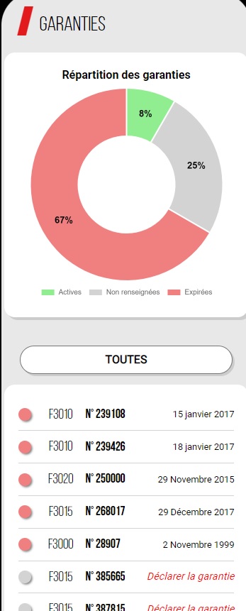
There is a page you can use to view the guarantees for your INFACO devices.
Users can declare their guarantees if this has not been done by the dealer (an invoice is required).
I
Parcel size advancement
Once the pruning shears are connected to my phone, I can go to work. My GPS position will be automatically sent to the my.infaco.com server to monitor pruning progress for the domain.
The plot progress calculation is a comparison between the previously configured plot surface area and the surface area of the pruned zone.
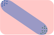
If several pruners have a box, it is important that they work together. If we take the example of two pruners working separately, the progress calculation will be incorrect. The image below shows the generated zone.
If the two pruners work on two consecutive rows, the result is a precise progress zone.

If you don't see any progress on your plot, it's important to check that geolocation is enabled on your smartphone.
Android tips:
Tip for Iphone:
On Android, GPS readings will not be recorded if the phone has no network. If the network is detected intermittently, readings will be less regular. Monitoring will be less accurate.
On Iphones, the GPS readings will not be stored in memory and will be sent to the server at the next connection to the network.
I
How to use POI
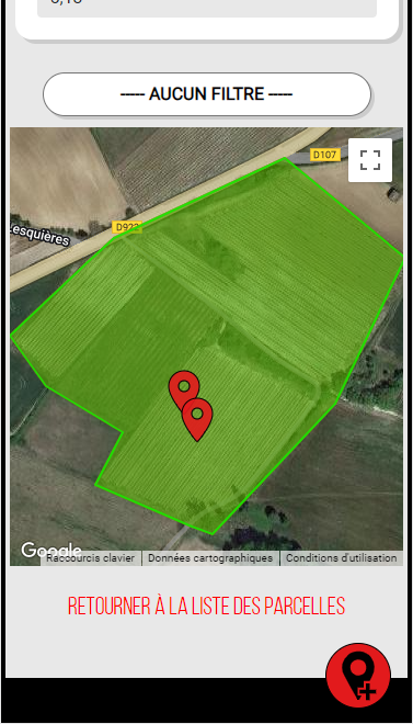
A point of interest (POI) is a quick and easy way of placing points of interest such as a diseased plant, cut wires, broken posts or any other item.
To add a POI just click the red button at the bottom of the page (as shown in the picture).
Le GPS position at declaration time has been saved.
All the POIs for a plot are visible on a map. (see picture below)
GPS navigation to a POI can also be initiated.
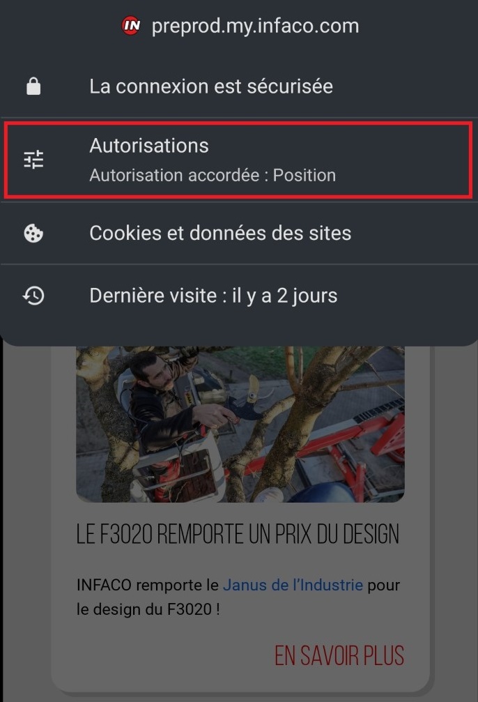
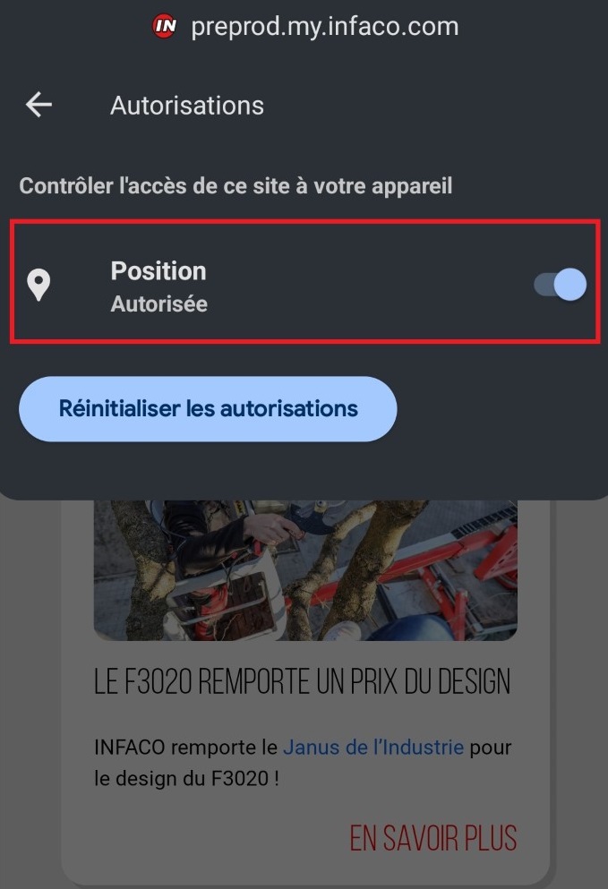
This feature is not available because it is not possible to geolocate you. Check the «Position» authorisation:
this error appears because your internet browser is not authorised to use geolocation.
Chrome/Android: click the button 🔒to the left of the search bar, then «Authorisations» and enable «Position» (see photos below)

Safari/IOS: click the «aA» button to the left of the search bar, then «Website settings» and enable «Position».
If the problem persists, check the device settings: Settings > Privacy and security > Location service > Safari sites
I
Mobile Application
No. GPS data is only recorded if the box is connected, the pruning shears are switched on and the shears have made 5 cuts. Pruning progress is not altered when pruners take a break.
Also,the data is not used if the reading is outside the plot. This also ensures that the pruning progress zone is not altered when the pruning shears are configured at home.